Last year a good friend of mine decided to canoe the Guyandotte river from Wyoming county to Barboursville for a meeting. We had a dry year and there wasn’t much water, which made it tough to paddle. He eventually ran out of time and had to get someone to meet him and drive him to the meeting. He had to (temporarily) abandon the journey in Lincoln county in a little town called Branchland. This is not the kind of thing you can leave unfinished. So when he asked me if I would like to finish the remaining 38 miles of the Guyandotte, down to it’s mouth where it meets the mighty Ohio, I said, “umm…YES!”
After working out most of the logistics for the trip, we finally arrived in Branchland at the same little boat ramp where he

Put in at Branchland.
put in last year. It is conveniently placed across the road from a small restaurant named, ‘Simply the Best,’ where we enjoyed what may be the best burger I’ve ever had…anywhere. Seriously, it was good! With some good food in us to provide plenty of calories to burn, we bid farewell to the shore and hit the water. It has been a pretty dry Summer, but recently there has been enough rain to bring some local water levels up, so we had plenty of murky water under us and a swift current assisting our paddling momentum. With relative ease we were moving at what seems like a blazing speed in a canoe…probably about 7mph. Being able to keep the pace without too much strenuous work, we knew we would have plenty of time to reach the Ohio by the next evening.
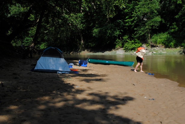
It was well after dark before we found a place to camp. We were enjoying the sunset and easy pace, and took as many breaks or distractions to stop and look at interesting things we saw on shore. Besides, being out on the river at night under a blanket of stars, and a serenade of frogs, is part creepy and part really cool. After some diligent searching by flashlight, it seemed as if we had passed all the decent places to stop for the evening, because all I was seeing were steep banks and impenetrable brush. Then all of a sudden my light hits something…I couldn’t quite tell what. Maybe another tree laying across our path? Maybe just a reflection of the bank showing on the water? Or maybe, could it be? A BEACH! Yes, out of no where there was a perfect little beach jutting out into a steep turn in the river. Flat, dry sand. Dry wood. And plenty of trees to shelter us from the view of roads and houses near by up above the steep banks. A few minutes later and camp was set up and a small fire crackling, a perfect ending to a long day. The next morning started early, as most do when you sleep outside, and it was clear blue skies, and getting hot already. Camp came down and packed up almost as fast and easy as it went up. We were ready for day two of the adventure.

Cleaning up camp.
Before railroads were built, and the coal mining industry boomed in the early 1900s, the Guyandotte river was a main vein of commerce and transportation in the rural, secluded mountains of what is now Southern West Virginia. In 1874 when Congress ordered a survey, ” it found $400,000 worth of timber and farm produce moving downstream each year, matched by 300 tons of merchandise shipped upriver” [1]. Although I’m no economist or mathematician, I used an inflation calculator and $400,000 in 1874 is equal to roughly $8,000,000 in 2012. $8,000,000!!! Imagine how $8,000,000 would immensely affect the local economies along the Guyandotte today…that’s hard to comprehend. Even though it brought commerce and prosperity, the river has always been a double edged sword to those who reside along its banks. Throughout history there have been many terrible floods, coming fast and without warning and bringing devastating destruction, as floods usually do. After several failed attempts to dam and regulate the Guyandotte, R.D. Bailey Lake, a permanent dam and reservoir was finished in 1980.

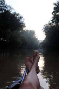
Kickin’ back.
In more recent history, the Guyandotte has served as a dumping ground for many local residents. As we floated down stream there was no shortage of tires, plastic bags, chairs, TVs, old pipes, and plenty of twisted, mangled, rusting metal. Unfortunately. The river is mostly shallow, maybe no deeper than 8ft in most places, and very, very sandy. You don’t see many rocks along the shore. In spite of all the trash, apparently, the water still tests cleaner that the Greenbrier according to my friend. Which is hard to believe because in comparison, the Greenbrier is pristine.
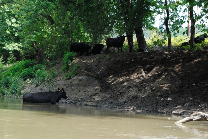
As we continued our journey Northward, yes, Northward. The Guyandotte in one of three rivers in West Virginia (that I’m aware of) that flows South to North. The others being the New river, which is birthed in North Carolina (and considered to be possibly one of the oldest rivers in North America), and the Kanawha, which is made up of the New and Gauley rivers. In fact, many Native Americans in the region ofter referred to the New and the Kanawha as one river. It, like the Guyandotte, runs into the Ohio. So as we continued Northward and down stream, we came upon plenty of interesting things. Just like the day before. Sometimes we would make bets about what a particular thing was, as things in a river can ofter look much different from a distance than they do up close. We saw about 14 cows and 4 people along the banks. Countless cranes, and other birds, as well as a few small, curious fish. As we started seeing more houses, hearing more traffic, and crossing under more bridges, we knew we were getting ever closer to Huntington, and to those juicy steaks awaiting us at Schooners.
When you’re in a canoe and have been on a river like the Guyandotte, popping out into the Ohio can be almost overwhelming. Speed boats, coal barges, wakes higher than your little canoe, being pushed around and fighting currents…it’s a real good time. But as soon as we drifted past the boat ramp and officially entered the waters of the mighty Ohio, and it is mighty indeed, a feeling of joy and accomplishment swept over us. It was finished! Kind of. We still had to paddle into the dock at Schooners, eat, and then unload the canoe and tie it down to the top of my Jeep. All in all it was a terrific trip, everything seemed to go seamlessly smooth. in fact it was so good that we’re already planning to paddle the entire 97 miles of the Kanawha!

A few of the 20 cows we saw…like the Mekong or something.

Crossing under I-64 near Huntington.

Getting ready to enter the Ohio!


